A hydrographic, geotechnical, geophysical report and new navigational chart to enhance the construction of the proposed Bakassi Deep Seaport has been presented to the Cross River State government.
Governor Bassey Otu, who received the chart at the Government House in Calabar, the capital of Cross River State, southern Nigeria, described the achievement as a milestone for development of the state into a maritime hub.
Visibly pleased with the report and chart, Governor Otu described the completion and presentation ceremony as “a historic milestone” that affirmed Nigeria’s maritime boundaries and a game changer for trade in the Gulf of Guinea.
The governor commended the Hydrographer of the Federation and Chief Executive Officer (CEO) of the National Hydrographic Agency of Nigeria, Rear Admiral Ayo Olugbode and his team for the feat achieved by developing a modernised chart of international standard.
He stated, “this is truly a historic day, not just for Cross River State, but for the entire country. What we have achieved today replaces charts dating back to 1903 and settles long-standing debates about Cross River’s status as a littoral state. This chart clearly affirms our coastal status.”
Speaking further on the updated chart, Governor Otu emphasised that it aligned with S-100 international standards and positioned Cross River State for deepwater commerce and cross Atlantic shipping operations.
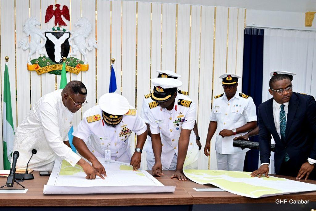
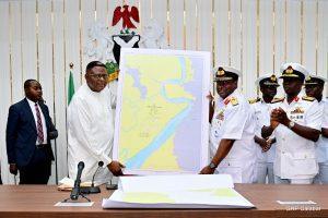
Cross River State Governor, Prince Bassey Otu (L), Hydrographer of the Federation, Rear Admiral Ayo Olugbode (R) flanked by other Senior Naval Personnel at the Presentation of Hydrographic and Geotechnical Survey Report and New Navigational Chart for the Bakassi Deep Seaport project to the governor at the Executive Council Chamber of the Governor’s Office, Calabar.
He further said, “we picked up this dream where the former governor, Professor Ben Ayade left off. Public funds had been committed, and we could not allow it to die. Today is another giant step toward its full realisation.”
He announced that the Bakassi Deep Seaport project was now set for the final approval from Nigeria’s Federal Executive Council for construction to commence.
Bedrock of Maritime Construction
Prior to the presentation of the documents, the CEO of the National Hydrographic Agency of Nigeria, Rear Admiral Olugbode accompanied by top naval officers attributed the achievement to an intensive multi-year effort, which commenced on December 21, 2024.
Rear Admiral Olugbode explained that the process was characterised by rigorous data acquisition starting from January 6, 2025, noting that the survey covered hydrographic, geophysical, and geotechnical dimensions to ensure safety, precision and compliance with international standards.
Olugbode further said, “this is more than just a technical report. It is the bedrock for constructing and operating the Bakassi Deep Seaport. It provides essential data for engineering designs, dredging, breakwater construction and navigation safety.”
He enumerated other benefits of the data to include “boost investor confidence, enable effective ocean governance and contribute to global initiatives such as Seabed 2030, a project aimed at developing a modernized map of the global seafloor by 2030.
He also appreciated Governor Otu for the support to the agency, which he acknowledged, created an enabling environment for the successful completion of the complex operation.
The vision for the Bakassi Deep Seaport is to catalyze investments in shipping, logistics, trade and tourism, while creating jobs and strengthening Cross River State and Nigeria’s position in the global blue economy.
